Sail With Dan

iOS and Android · English and Italian

When the mark is dead upwind, it plans the beat.

A phone-based sailing instrument for skippers who already know how to sail. It draws the boards and names the tack, shows speed over ground (SOG), course, and true wind at the helm, and stands an overnight anchor watch. One small price instead of a stack of plotter subscriptions.

7-day full trial. Then $24.99 a year, or $69.99 once. An aid to navigation, not a primary means of navigation.

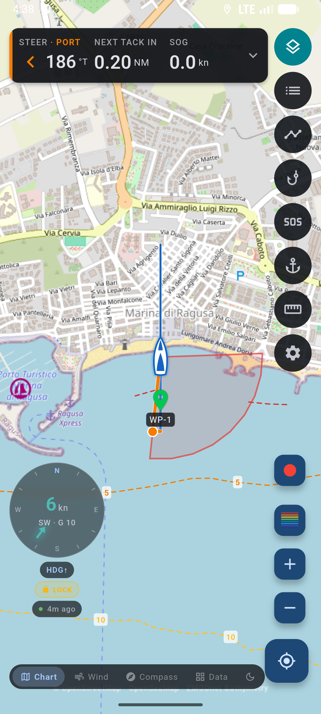
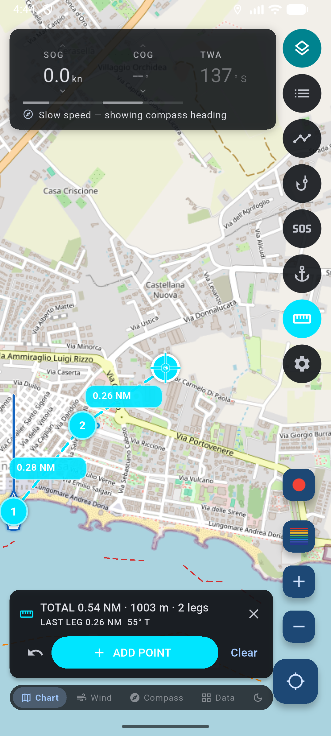
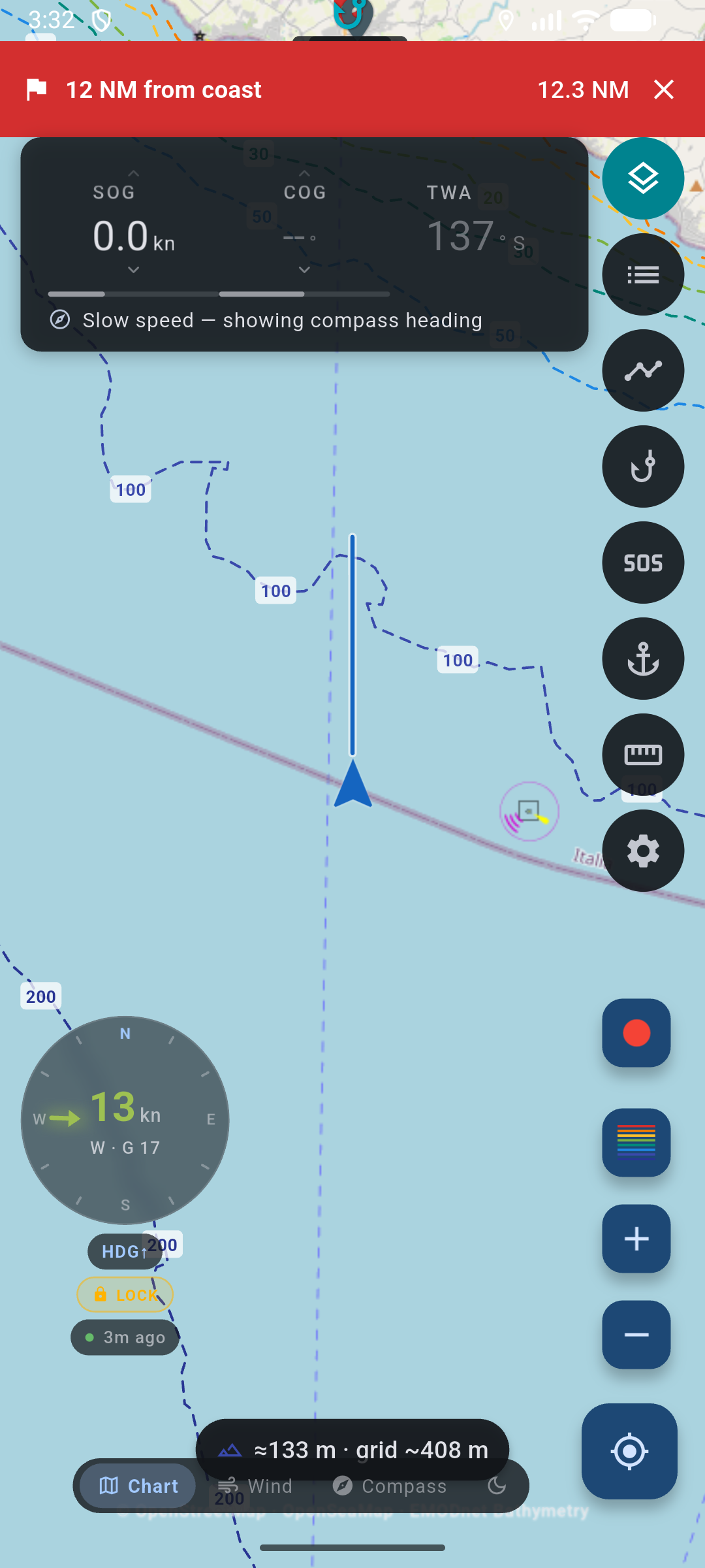
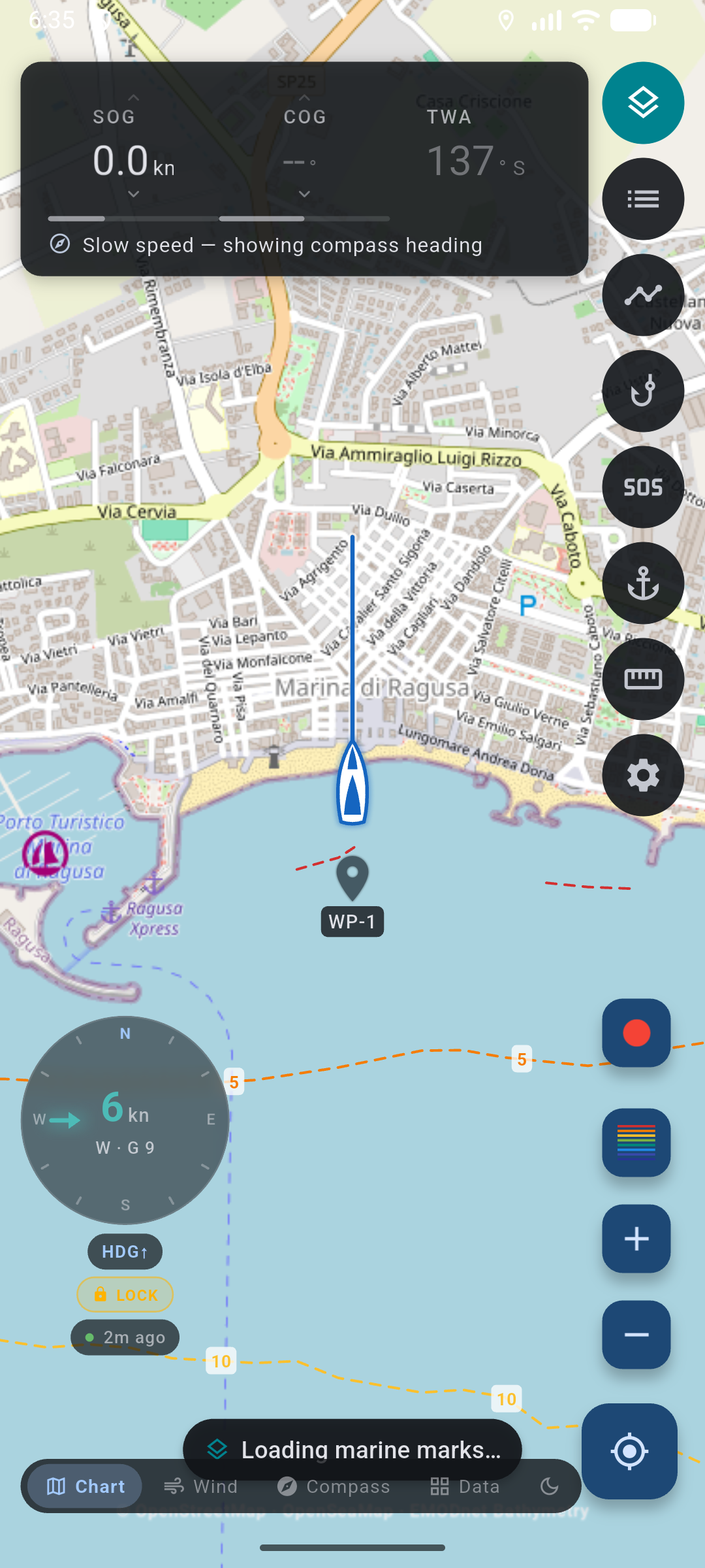
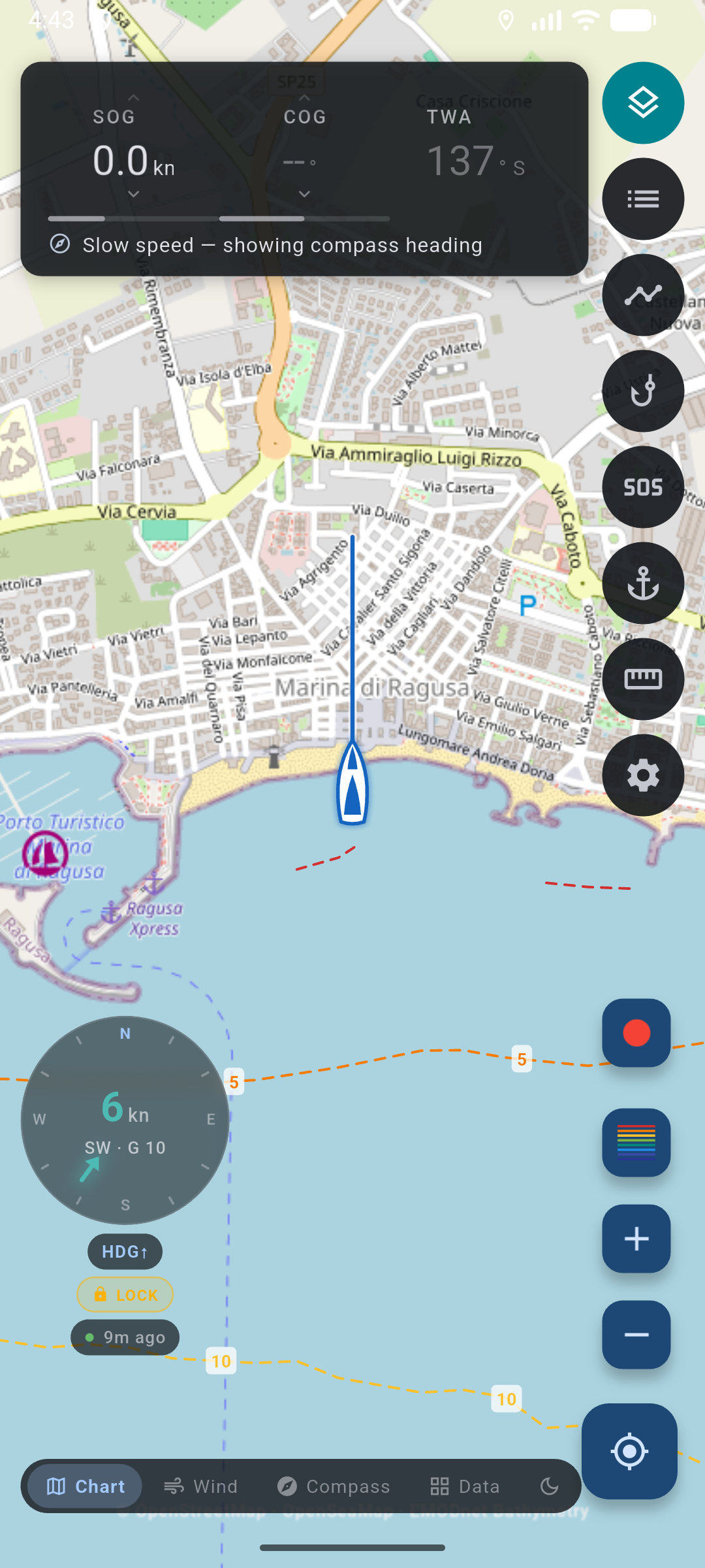
Chart helm off Marina di Ragusa: live SOG, COG, and TWA columns, heading-up wind dial, boat with heading ray over depth contours.

Wind-aware routing

The mark sits in the no-go. It gives you the boards and the turns.

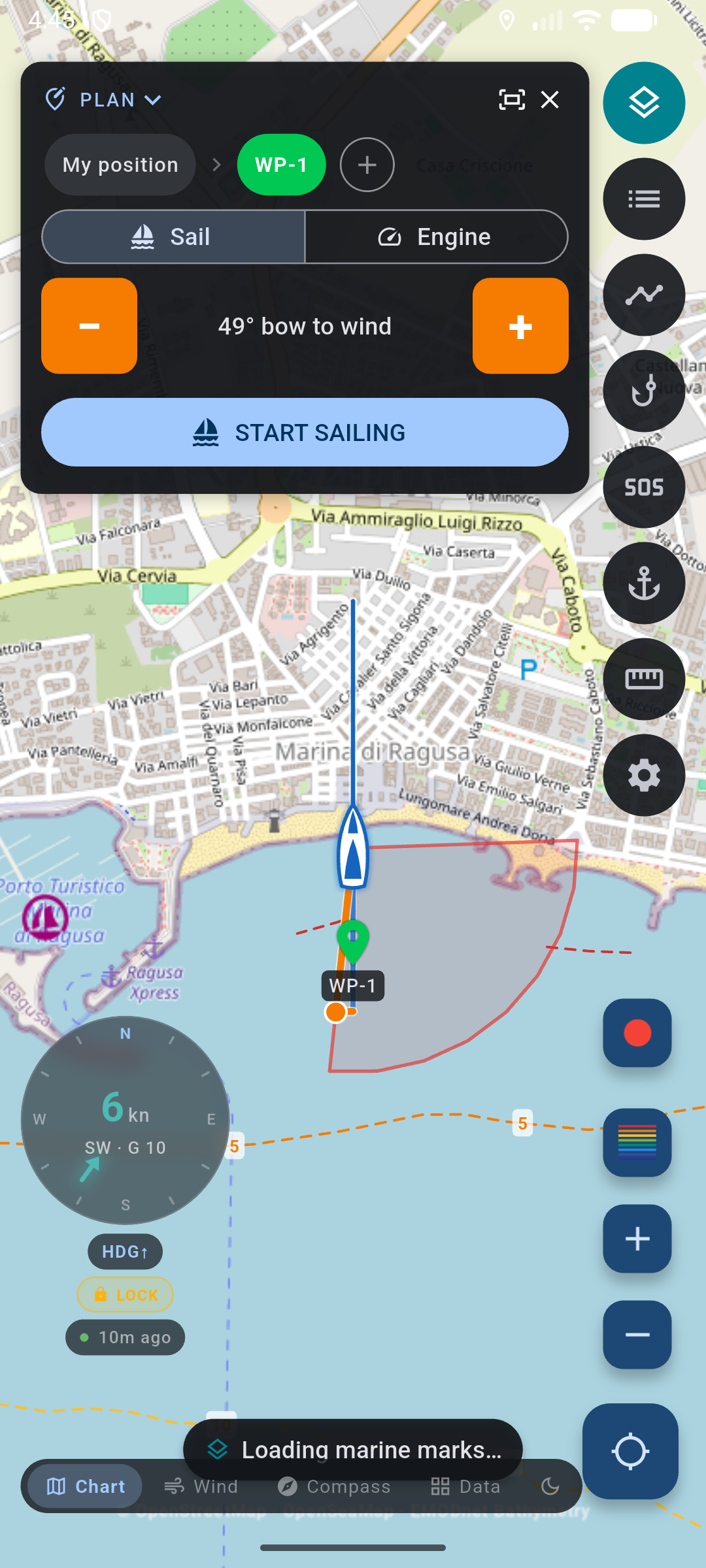
Sail With Dan fits a zigzag to the forecast wind and your polar, names the tack, and counts down the distance to the next turn. It solves for time on the water, not distance over the ground, so the faster pair of boards wins. Switch to Engine and it follows the rhumb line at motor speed instead.

The router checks the coastline only. It knows nothing about depth, shoals, rocks, or traffic. You still vet every board.

Beat planned to a mark upwind: BEATING UPWIND panel with Sail or Engine and Start sailing.

Helm

At the wheel you want three numbers, not a menu.

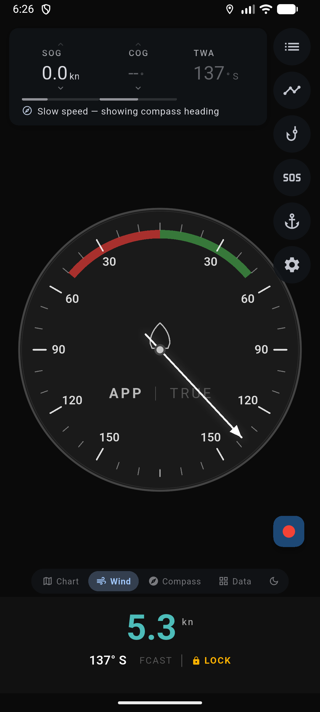
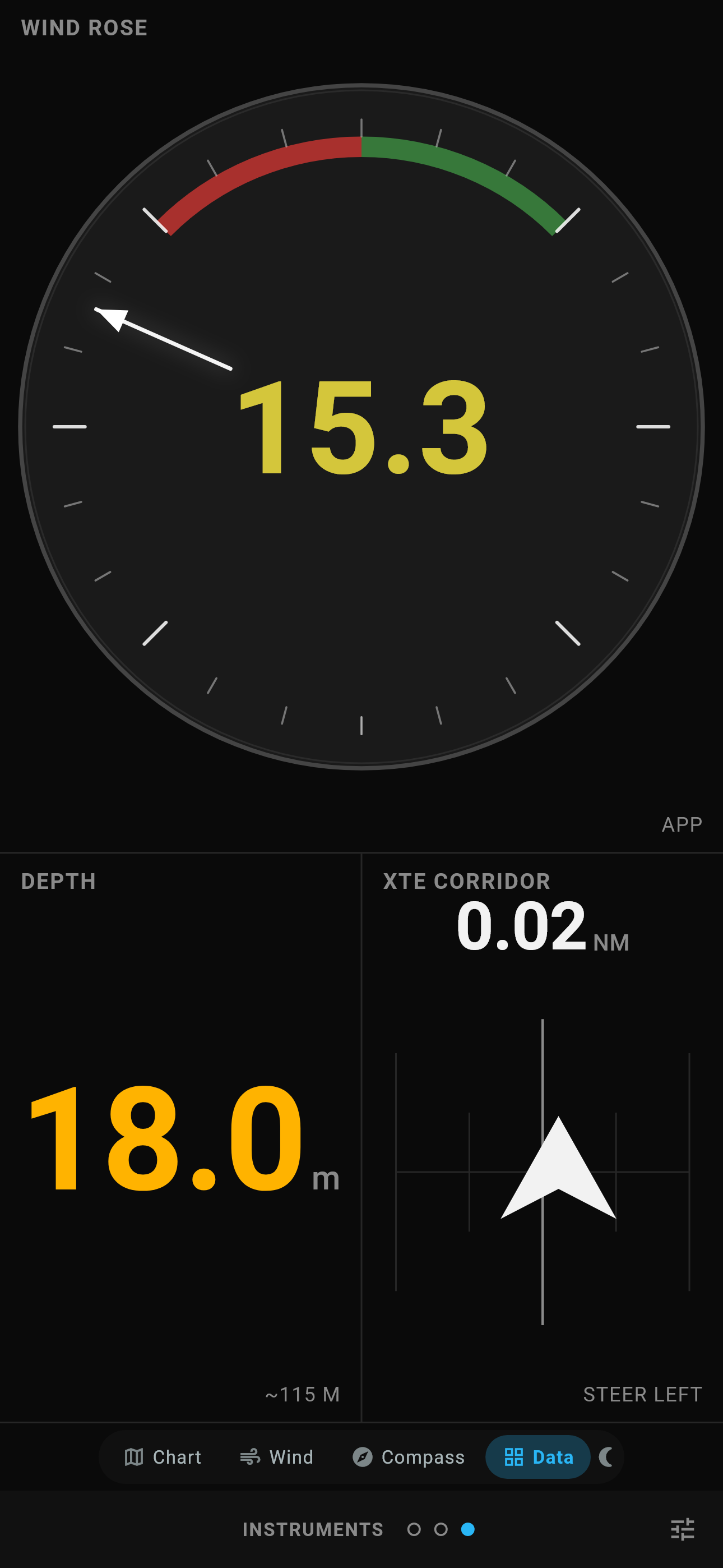
Three swipeable columns sit on the chart: speed with velocity made good (VMG), course over ground (COG) with apparent wind, and true wind angle (TWA). The Wind page turns the phone into a heading-up analog dial with the port and starboard no-go arcs drawn in, and the needle locks when the forecast is wrong and the telltales are right.

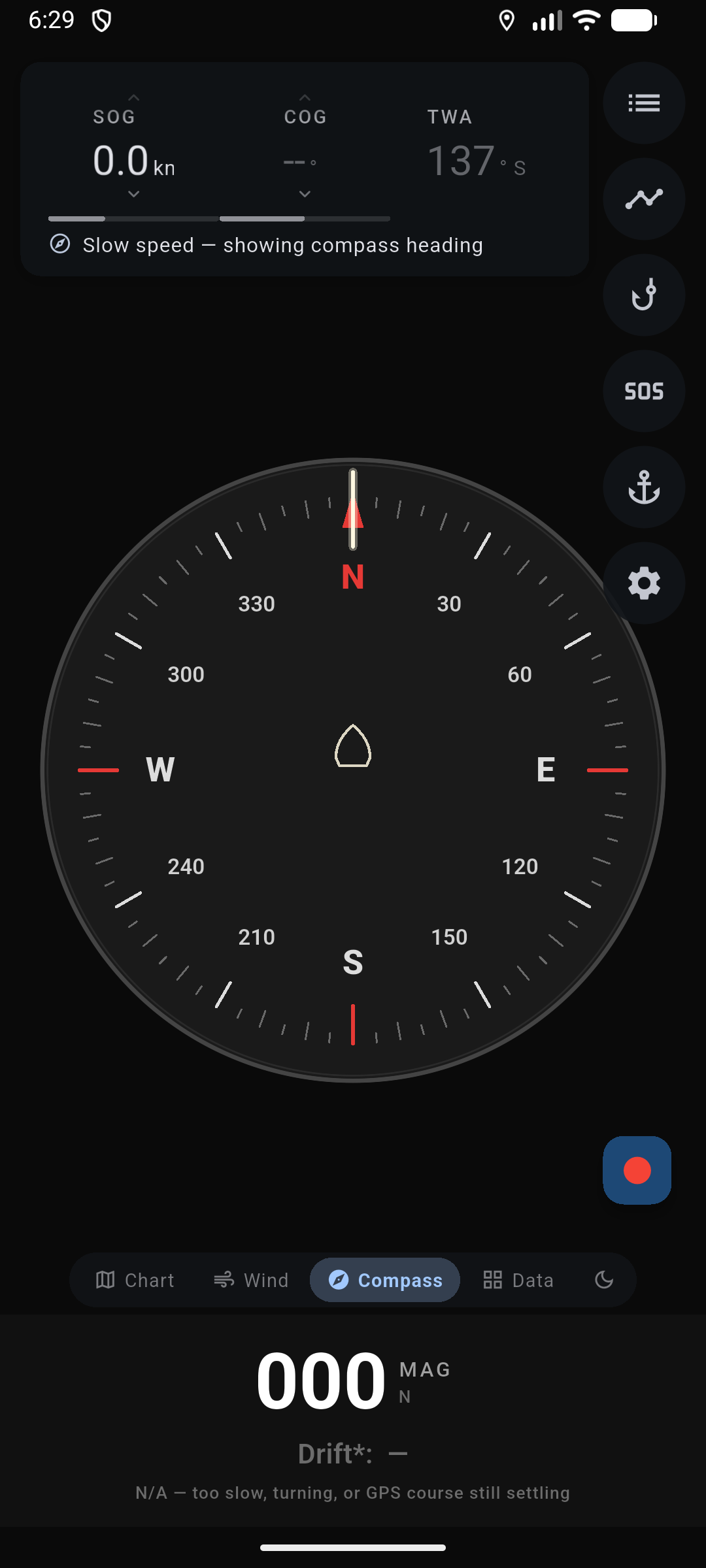
Speed and course come from the phone GPS. Below about a knot, course falls back to the compass and the display says so.

Full-screen analog wind instrument: needle at TWA, red port and green starboard no-go arcs, forecast or locked wind.

Forecast

A forecast is only useful when you know how old it is.

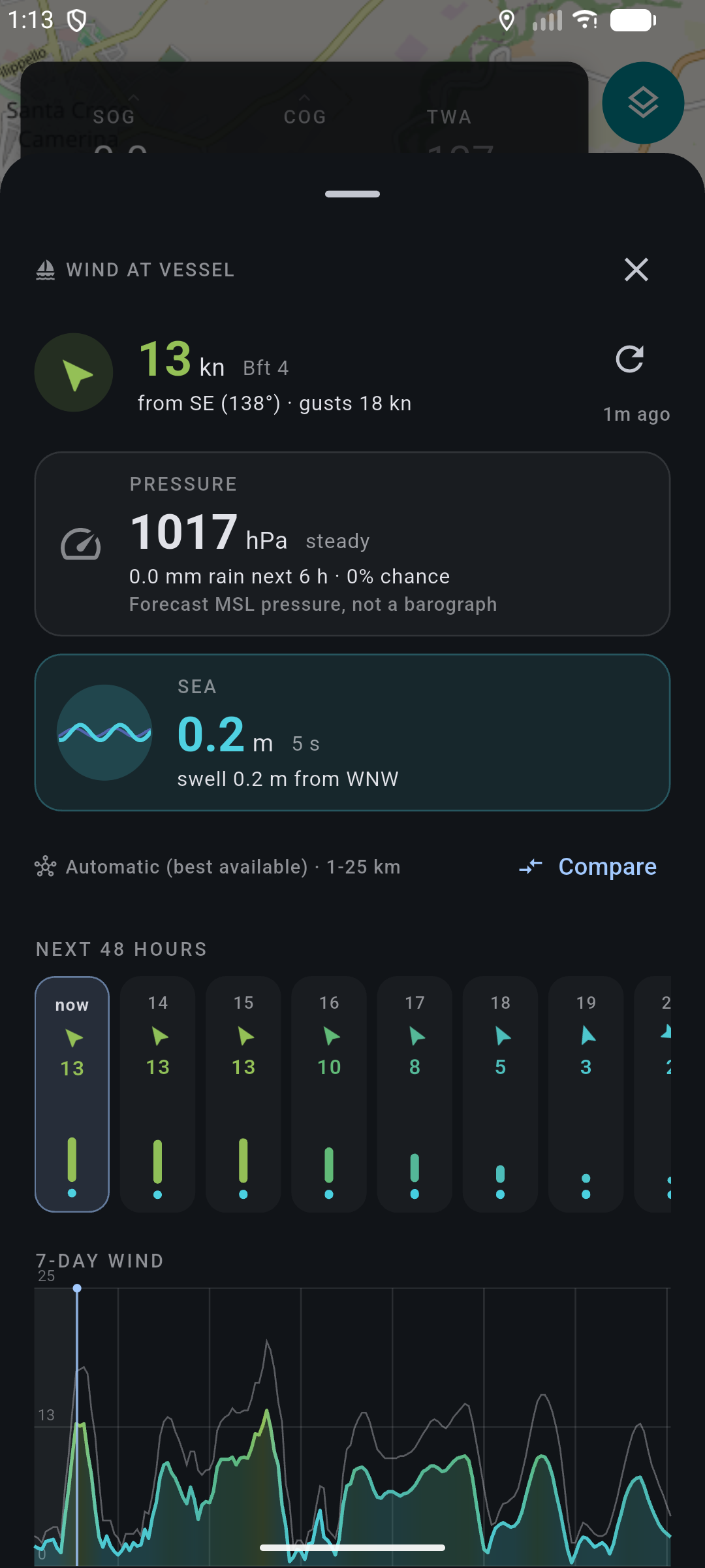
Wind comes from Open-Meteo with no key to manage: ECMWF, ICON, ARPEGE, GFS, and regional models you can compare side by side. The figure on screen is interpolated to now through the hourly series, and the age of the fetch is printed next to it. The next 48 hours in detail, seven days as a curve.

This is a forecast, not a masthead unit. Stale data stays on screen instead of quietly disappearing, so you can judge it yourself.

Open-Meteo wind sheet: wind and gusts now, next 48 hours, seven-day speed curve, model name and forecast age.

Anchor watch

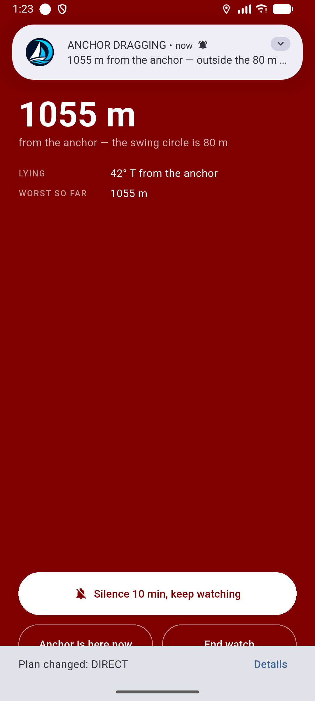
Anchored overnight, the alarm loops until you silence it.

Drop the mark, set the swing radius in meters, and turn in. After two GPS fixes outside the circle the phone sounds on the alarm stream, through a silenced ringer. Distance from the mark, worst drift so far, and the circle itself stay on the chart.

It works off the phone GPS. When reported accuracy is coarse for the radius you set, the app tells you instead of pretending.

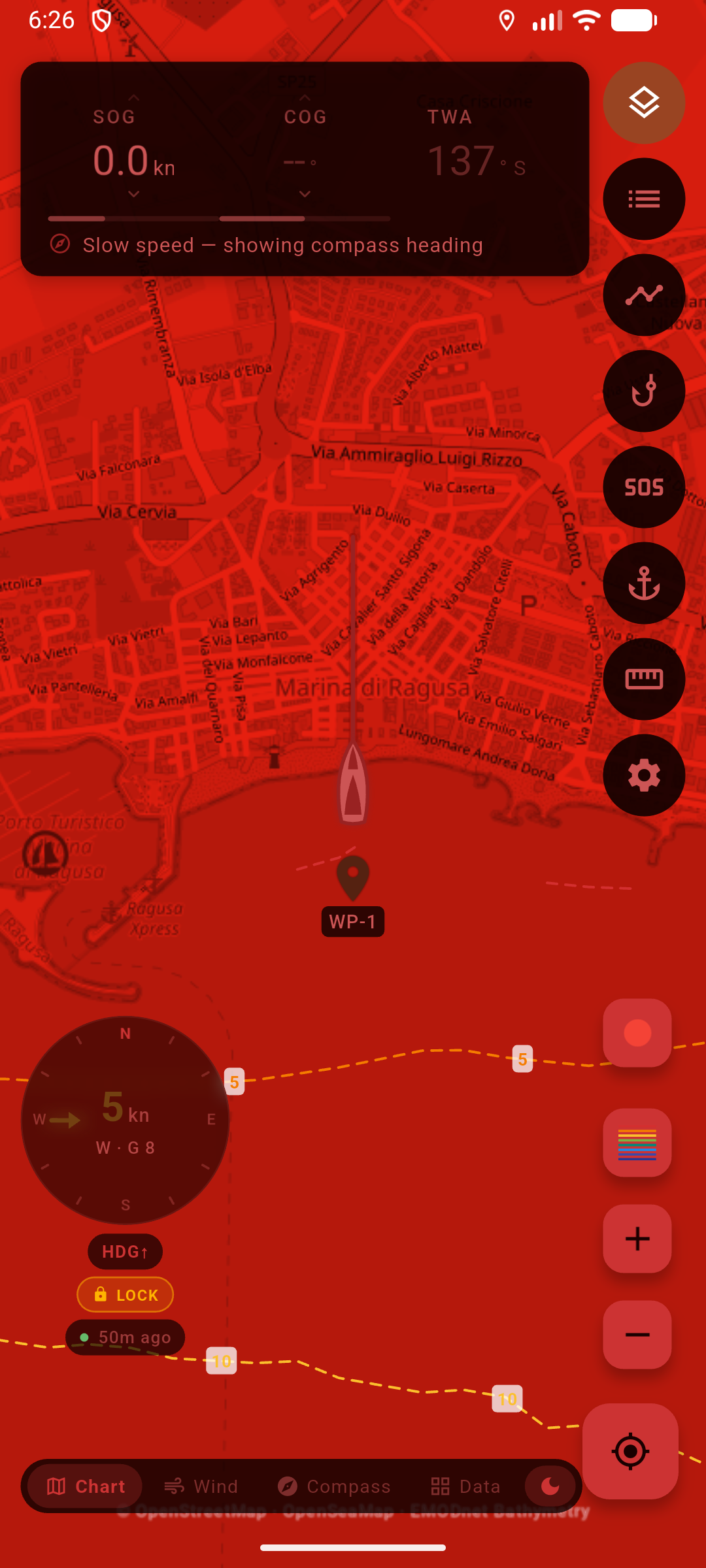
Full-screen ANCHOR DRAGGING alarm: distance from the mark, 80 m swing radius, Silence or End watch.

Tracks

The passage is worth keeping. Record it, then export GPX.

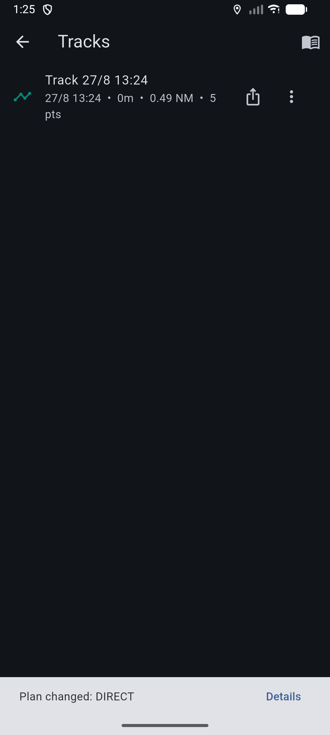
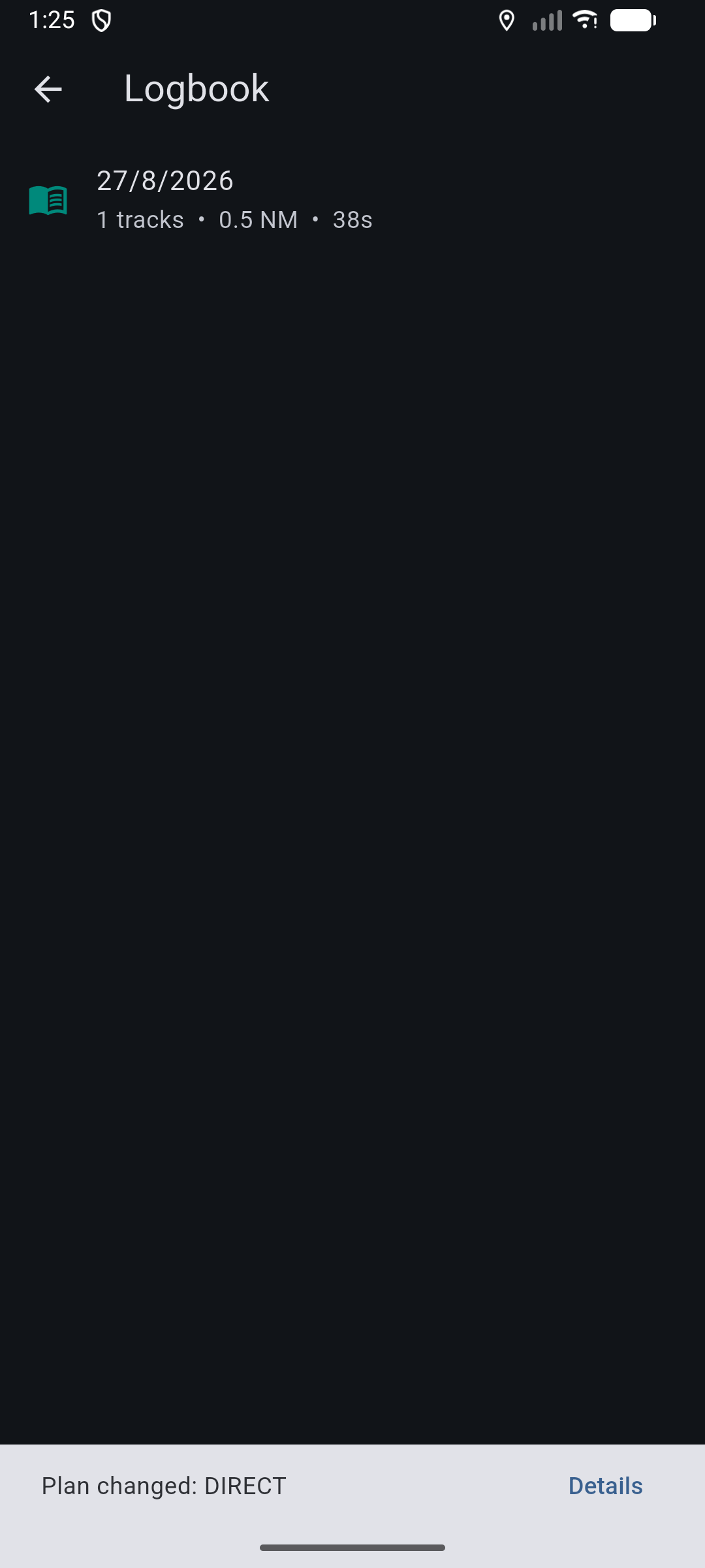
A teal trail follows the boat, takes a name when you stop, and lands in a list with distance in nautical miles (NM), duration, and point count. Export the .gpx and open it in OpenCPN, Garmin, or anything else that reads the format.

If the app is killed mid-recording, the track closes at the last fix. It will not stitch over the gap.

Tracks list: saved recording with duration, distance in nautical miles, point count, and GPX export.

Depth

Depth contours for orientation, drawn dashed for a reason.

EMODnet bathymetry across European waters, traced as isobaths — depth contours — at sailing intervals from 2 to 200 meters. Tap the chart for a reading, watch the chip under the boat, and arm a shallow-water backstop if you want one.

Modeled from roughly 115 m cells and coarsest inshore. It is not a chart, not a sounder, and it is never fed to the router.

Nautical chart with dashed EMODnet depth contours labeled 20, 50, 100, and 200 meters.

Scope

Who it is for, and what is not in it.

Who it is for

Coastal cruising skippers, roughly 30 to 45 ft, in the Mediterranean and around Europe. Club sailors who want a beat or gybe plan without a routing workstation. Charter skippers who want helm numbers and an alarm they can sleep next to. You already know how to sail. Nothing here teaches you.

Engine mode exists and powerboats can use it, but the app thinks in sails. It is not built for anyone learning port from starboard, for fishing depth charts, or for SOLAS commercial use.

What is not in it

Official charts
No ENC, no hydrographic office licenses. Keep navigating on the charts you already carry.
Tides and currents
Not modeled, not displayed, not used when a route is planned.
AIS and radar
No traffic on the screen. The lookout is you.
Boat instrument networks
It reads the phone GPS and compass. Nothing on an NMEA bus, no masthead wind.
Soundings
Depth is modeled bathymetry for orientation, not survey data and not a sounder.
Depth outside Europe
EMODnet coverage ends at European waters. The rest of the chart still works.

Pricing

$24.99 a year. Or $69.99 once.

Seven days of the full app, every feature, no trimming. After that it is $24.99 a year, or $69.99 once. The price pays for the app, the updates, and keeping it running.

Cancel anytime

Yearly

$24.99/year

One year of the full app. Cancel when the season ends. There is no monthly plan.

Start 7-day trial
Pay once

Lifetime

$69.99 once

First 90 days after launch: $49.99

The same app, with no renewal. Intro price for 90 days after launch.

Start 7-day trial

Prices in US dollars, before store tax. Billing is not live yet. For 90 days after launch, lifetime is $49.99; after that it is $69.99.

Safety

An aid to navigation. Not a primary means of navigation.

Sail With Dan is an aid to navigation, not a primary means of navigation. It does not replace official charts, an echo sounder, a lookout, or your judgment. Chart and depth data are not survey-grade. A route that “stays in water” has been checked against drawn coastline only.

  • The app is not ENC or ECDIS data and does not meet SOLAS chart carriage requirements. Only official government charts and Notices to Mariners carry everything needed for safe navigation.
  • Chart, seamark, weather, and depth data come from third parties: OpenStreetMap, OpenSeaMap, Open-Meteo, and EMODnet. None of it is surveyed for navigation.
  • Depth is modeled from roughly 115 m cells, coarsest inshore, and is never used to plan a route. Contours are drawn dashed to say so.
  • Routes and forecasts are planning aids. You vet every board, and you keep the watch.
  • Position, course, and the anchor alarm depend on phone GPS, which has accuracy limits at low speed and in poor reception.
  • You remain responsible for the vessel, the lookout, and the passage.

Data

Where the numbers come from.

Nothing here is proprietary or surveyed. Naming the sources is how you judge what to trust.

OpenStreetMap and OpenSeaMap
Coastline, harbors, and seamarks. Community-maintained, not a hydrographic survey.
Open-Meteo
Wind and weather from ECMWF, ICON, ARPEGE, GFS, and regional models, with the fetch age shown.
EMODnet Bathymetry
Modeled depth contours for European waters at roughly 115 m resolution.
Your phone
Position, speed, course, and heading come from the device GPS and compass. No boat network is read.

Download for iOS or Android.

Seven days of the full app, then $24.99 a year or $69.99 once. Store listings are not live yet.